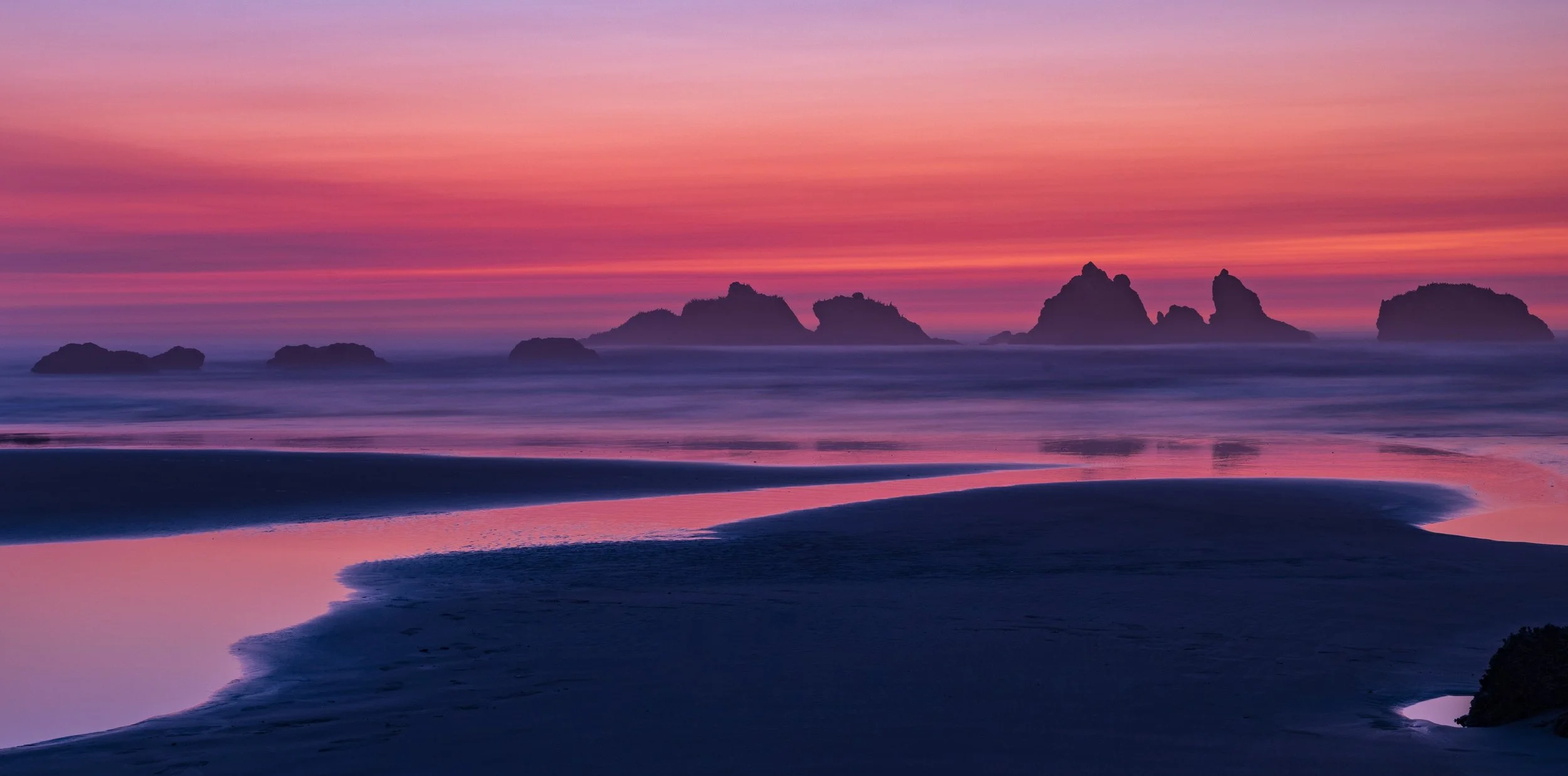
Todays’ walk…
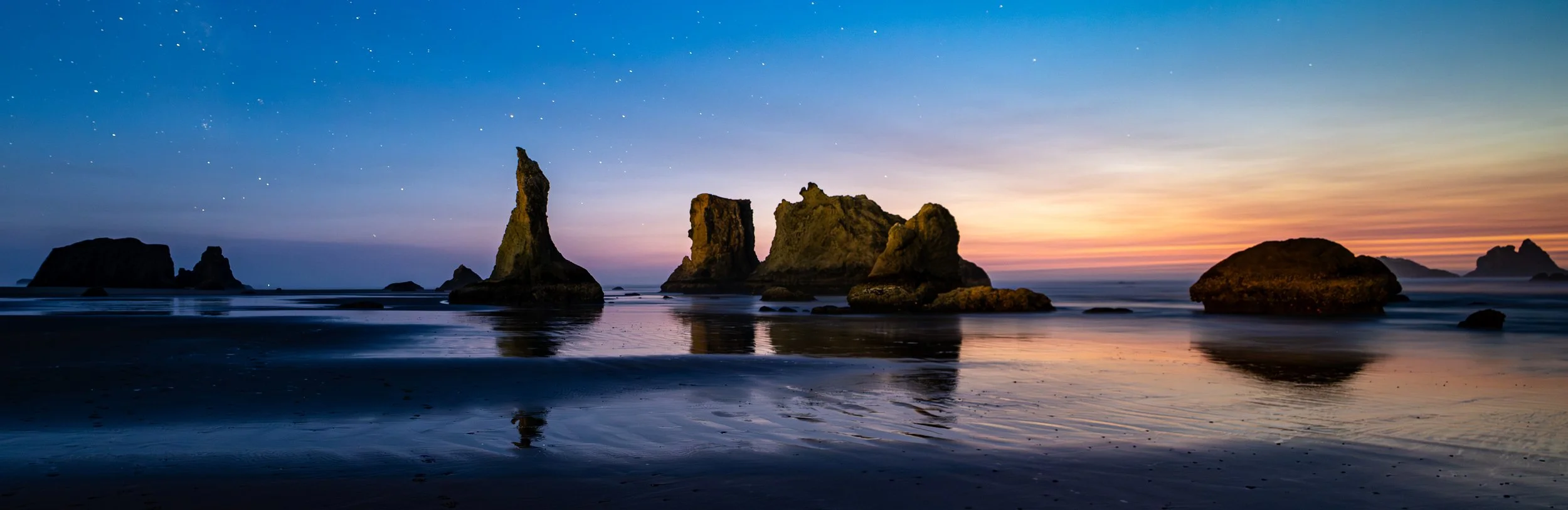
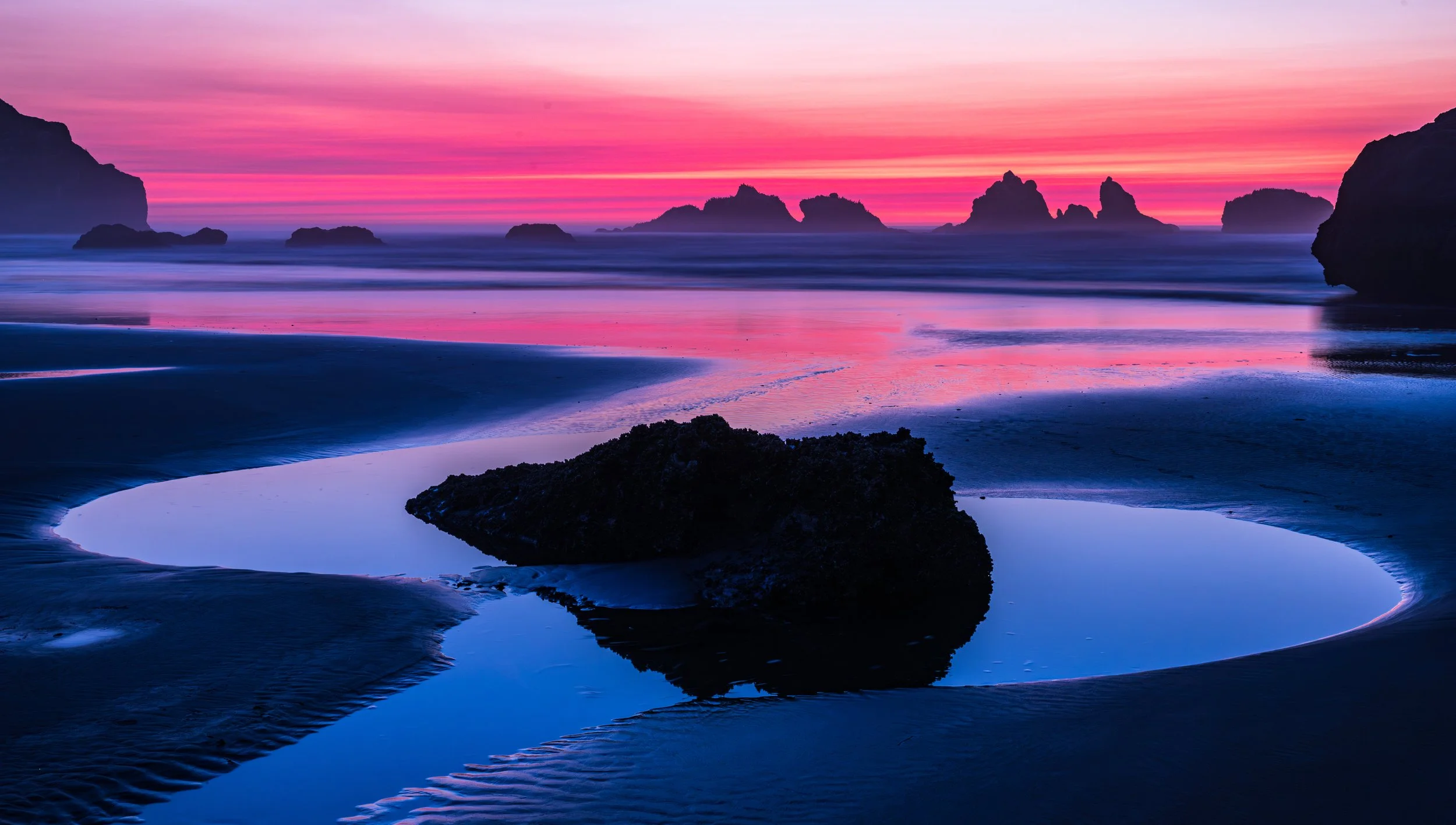
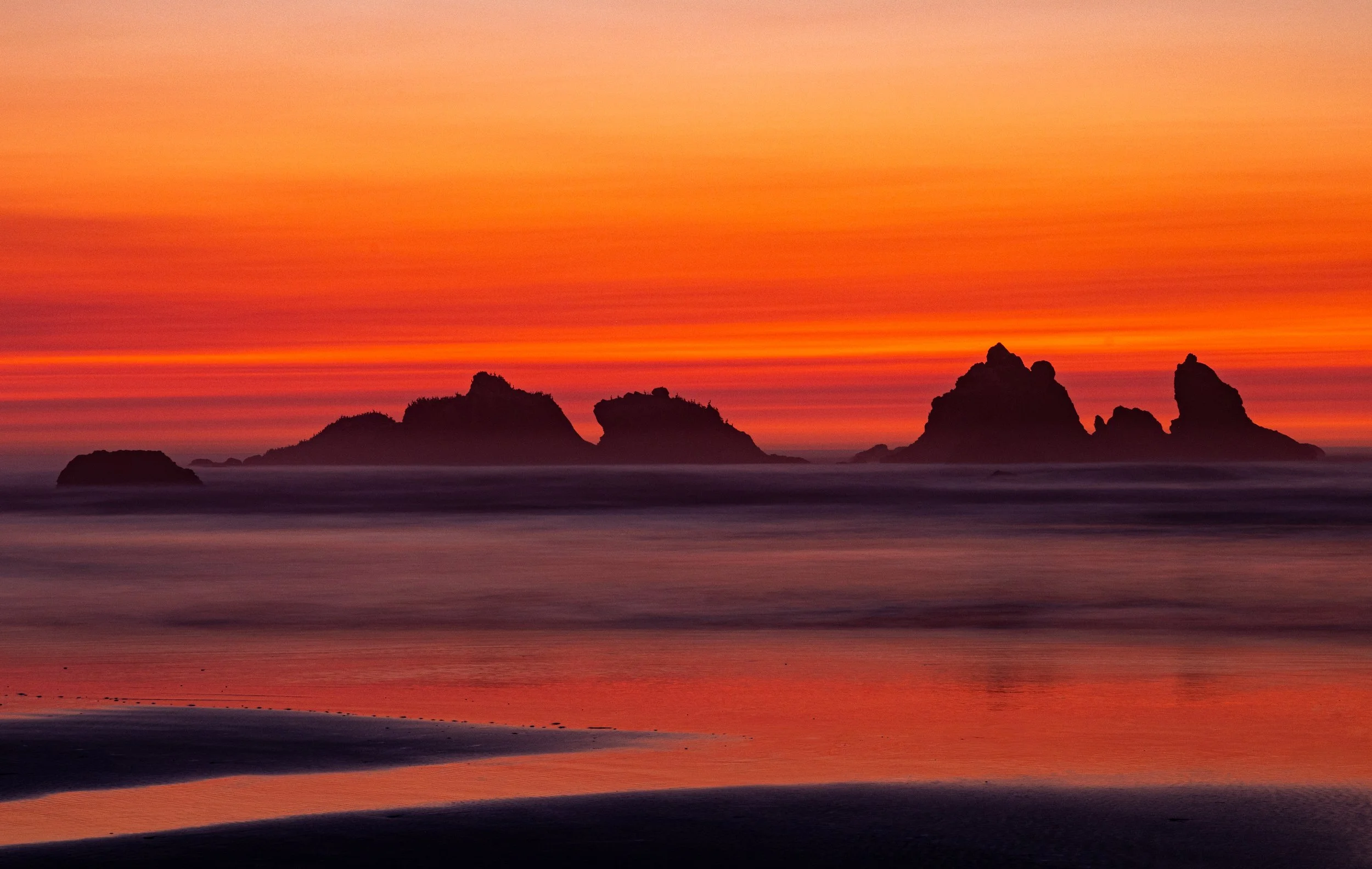
Every day in Bandon tells a new story, and today’s walk was no exception. We wandered the streets, watched the light shift across the local seastacks, viewed the lighthouse on the Coquille River, met friendly faces in Old Town, and paused for those small, perfect moments that make life here feel extraordinary.
If you couldn’t join us in person, you’re still part of the adventure.
Explore the gallery from today’s walk, download your favorite images, and see Bandon the way we saw it—up close, unhurried, and full of life.
Whether you’re a local, a traveler, or simply someone who loves the Oregon coast, you’re invited to celebrate the beauty of southern Oregon with us. Come walk with us, discover something new, and enjoy the magic that happens when we slow down and look around.
See what we saw.
Share what you love.
Celebrate life in Bandon and the Oregon coast…
Image download PIN: 7525
Low-resolution image downloads are free.
High-resolution files and prints are available for purchase.
~
Blog
📸 Face Rock Scenic Viewpoint Photography Recommendations (Bandon Oregon)
Face Rock State Scenic Viewpoint in Bandon Oregon is one of the most inspiring places to photograph on the Oregon Coast, but capturing its full magic takes more than pointing your camera at the sea stack. This guide shares practical, creative tips—using leading lines, foreground elements, sun position, and wildlife—to help you create images that feel alive, balanced, and uniquely your own.
Face Rock is one of the most inspiring places to photograph on the Oregon Coast, but capturing its full magic takes more than pointing your camera at the sea stack. This guide shares practical, creative tips—using leading lines, foreground elements, sun position, and wildlife—to help you create images that feel alive, balanced, and uniquely your own.
This is article is a practical, creative guide for making stronger images on one of Bandon’s most iconic beaches.
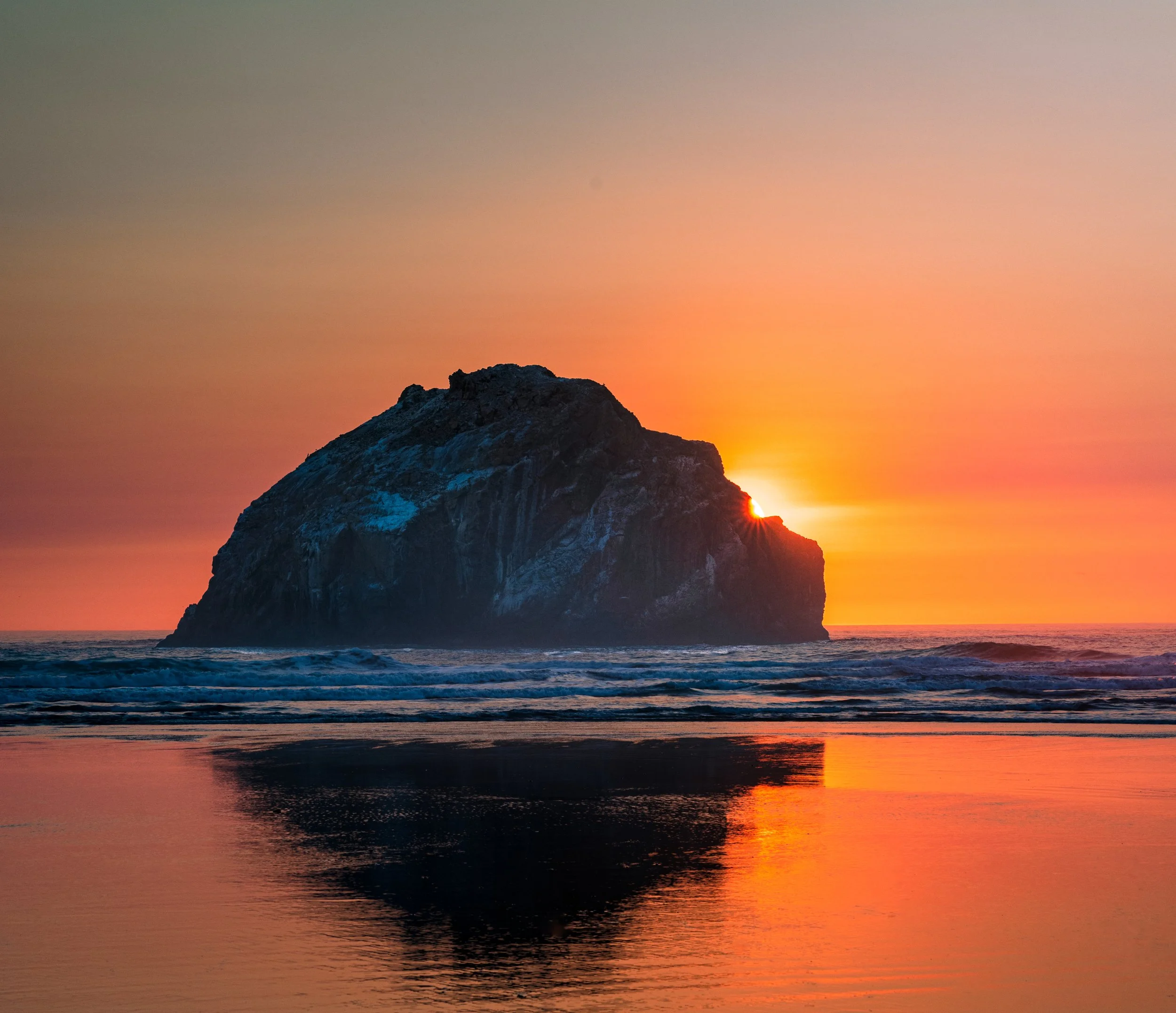
Face Rock at Sunset
1. Use the Beach’s Natural Leading Lines
Face Rock Beach is full of subtle lines that guide the eye if you know where to look.
Receding wave lines: On a falling tide, the thin reflective sheen creates diagonal streaks that naturally point toward Face Rock or the Cat & Kittens. Time your shutter to catch the pullback rather than the incoming wave.
Sand ripples: After a storm or very low tide, ripples form perfect foreground geometry. Position them so they angle toward your main subject.
Rock shadows: Near sunset, long shadows from the smaller sea stacks create dramatic directional lines—use them to steer the viewer’s eye.
2. Build Depth With Foreground Elements
Face Rock is so visually dominant that many photographers forget to anchor the frame.
Tide pools: At low tide, pools near the base of the stairs create mirror-like foregrounds. A small pool with a clean reflection adds instant depth.
Kelp, driftwood, or foam trails: A single piece of kelp or a foam swirl can add scale and texture without cluttering the frame.
Wet sand reflections: One of Bandon’s superpowers. Step back 10–20 feet from the waterline and use the reflective sheen as a foreground “canvas.”
3. Think About Sun Placement
Face Rock behaves differently depending on the season and cloud cover.
Classic sunset alignment: In winter and early spring, the sun sets farther south, giving you side‑light across the rock’s face—great for texture.
Summer sunsets: The sun moves north and can backlight the sea stacks, creating silhouettes and glowing edges.
Golden hour glow: Even when the sun is behind clouds, the sky often lights up behind Face Rock. Keep shooting after the sun dips; Bandon frequently delivers a second wave of color.

4. Allow the Image to Breathe
Face Rock is visually heavy. Give it space.
Use negative space: A wide sky or a clean stretch of reflective sand helps the composition feel calm and intentional.
Avoid crowding the edges: Let the main stack sit comfortably within the frame—don’t trap it against the border.
Simplify: If the scene feels busy, lower your angle or move a few steps to eliminate competing rocks.
5. Capture Birds for Scale and Life
Face Rock is a bird highway if you pay attention.
Look for cormorants: They often perch on the smaller stacks to the south. A single bird silhouette adds scale and mood.
Shorebirds in the shallows: Sandpipers and plovers run along the reflective waterline—perfect for motion blur or crisp action shots.
Gulls in flight: They frequently cross the sun path during sunset. A well‑timed frame with a seagull adds dynamic energy.
6. Work With the Tide
Tide changes transform the beach more than the weather does.
Low tide: Best for reflections, tide pools, and leading lines.
Incoming tide: Great for wave motion blur and dramatic water movement around the smaller stacks.
High tide: Simplifies the scene—use it for minimalism and silhouettes.
7. Move—Don’t Stay in One Spot
Most visitors shoot from the staircase area. The magic often happens elsewhere.
Walk north for cleaner sand, fewer footprints, and stronger reflections.
Walk south for more dramatic angles on the Cat & Kittens and better bird activity.
Shift your height: A 6–12 inch change in camera height can completely transform the foreground.

📸 The Best Times of Year for Photography in Bandon, Oregon (2026 Guide)
A month‑by‑month photographer’s almanac for the Southern Oregon Coast
This 2026 guide gives photographers a clear sense of what to expect—sunrise/sunset quality, storm potential, community events, art happenings, and notable astronomical moments—organized month by month.
A month‑by‑month photographer’s almanac for the Southern Oregon Coast
Bandon is one of those rare places where every month brings a different kind of magic. Some seasons deliver fiery sunsets, others bring towering storm waves, and others offer calm, pastel mornings or star‑filled skies. This 2026 guide gives photographers a clear sense of what to expect—sunrise/sunset quality, storm potential, community events, art happenings, and notable astronomical moments—organized month by month.
🌅 January 2026 — Storm Drama & Fiery Winter Skies
Sunrises/Sunsets: Some of the best of the year. Winter storm breaks create glowing skies.
Storms: Peak season for massive Pacific swells—excellent for Shore Acres wave photography.
Astrology: Long nights, dark skies; Milky Way not visible but stars are crisp.
Events: New Year’s Day Polar Plunge (Port Orford), winter art exhibits at Washed Ashore.
Why Shoot: Low-angle light all day, moody skies, dramatic surf.
🌧️ February 2026 — Storms, Rainbows & Wild Seas
Sunrises/Sunsets: Similar to January—high potential for explosive color.
Storms: Another prime month for wave action and dramatic clouds.
Astrology: Dark skies early in the month; good for star trails.
Events: Valentine’s weekend events, local gallery openings.
Why Shoot: Storm clearing windows create unforgettable golden hours.
🌤️ March 2026 — Transition Light & Early Spring Color
Sunrises/Sunsets: Increasingly vibrant; more pastel mornings.
Storms: Still active but less frequent.
Astrology: Milky Way core begins to return late at night.
Events: Spring break crowds; Bandon’s early spring markets.
Why Shoot: Wildflowers begin inland; dramatic skies still common.
🌷 April 2026 — Crisp Mornings & Calm Seas
Sunrises/Sunsets: Clearer skies, softer color.
Storms: Fewer, but occasional dramatic fronts.
Astrology: Milky Way visible in early morning hours.
Events: Easter weekend events, Port Orford art walks.
Why Shoot: Great month for long exposures and reflections.
🌼 May 2026 — Golden Light & Low Wind
Sunrises/Sunsets: Consistently beautiful, especially sunsets.
Storms: Mostly gone; calmer ocean.
Astrology: Excellent Milky Way conditions after midnight.
Events: Bandon’s spring markets, Memorial Day weekend activities.
Why Shoot: One of the best months for clean, crisp coastal landscapes.
🌞 June 2026 — Long Days & Soft Coastal Fog
Sunrises/Sunsets: Long golden hours; fog creates dreamy diffusion.
Storms: Rare.
Astrology: Short nights; Milky Way visible but limited window.
Events: Summer solstice celebrations, farmers markets.
Why Shoot: Foggy mornings at Face Rock are iconic this time of year.
🌊 July 2026 — Fog, Festivals & Fireworks
Sunrises/Sunsets: Foggy mornings, clear evenings.
Storms: None.
Astrology: Short nights; Milky Way visible late.
Events: 4th of July fireworks over the Coquille River, Bandon’s summer festivals.
Why Shoot: Fireworks reflections, warm evenings, dramatic fog layers.
🌅 August 2026 — Peak Summer Color & Warm Nights
Sunrises/Sunsets: Clear, warm, and often colorful.
Storms: None.
Astrology: Excellent Milky Way visibility at reasonable hours.
Events: Art in the Park, Port Orford festivals.
Why Shoot: Best month for astrophotography on the coast.
🍂 September 2026 — The Hidden Gem Month
Sunrises/Sunsets: Some of the best sunsets of the year.
Storms: Occasional early-season fronts add drama.
Astrology: Milky Way still strong early in the month.
Events: Cranberry Festival (Bandon’s signature event).
Why Shoot: Warm, clear evenings with spectacular color.
🍁 October 2026 — Peak Sunset Season
Sunrises/Sunsets: Top-tier sunsets—fiery, layered, dramatic.
Storms: First big swells return.
Astrology: Longer nights; great for star photography.
Events: Fall art shows, Halloween events.
Why Shoot: This is the month for photographers in Bandon.
🌧️ November 2026 — Storm Season Returns
Sunrises/Sunsets: High potential for dramatic skies.
Storms: Big waves, heavy surf—Shore Acres becomes world-class.
Astrology: Dark skies; Milky Way season ends but stars are sharp.
Events: Thanksgiving markets, early holiday art fairs.
Why Shoot: Storm light + low-angle sun = magic.
❄️ December 2026 — Moody Light & Holiday Glow
Sunrises/Sunsets: Short days, long golden hours.
Storms: Frequent, powerful, photogenic.
Astrology: Long nights for star trails and moonlit seascapes.
Events: Holiday lights, Winter Whale Watch Week.
Why Shoot: Dramatic winter skies and festive town scenes.
⭐ Summary: Best Months by Category
Category Best Months
Sunsets January, February, September, October
Sunrises April, May, June
Storm Photography November–February
Milky Way March–September
Foggy Dreamscapes June–July
Community Events July, September, December
Art Events February, April, July, September, December
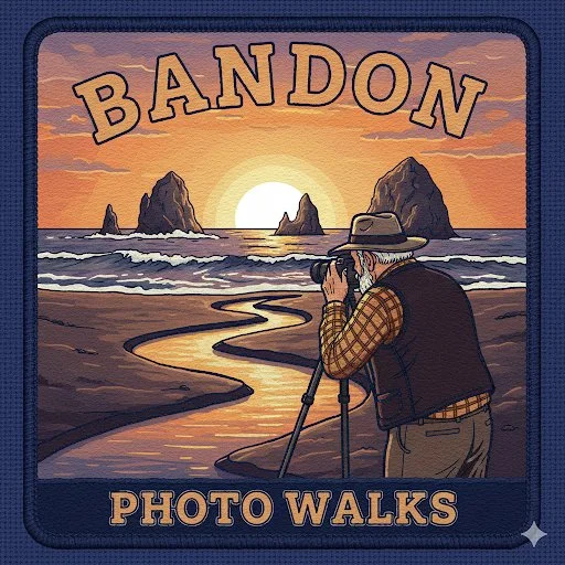
Bandon Photo Walks
Join a local Bandon photographer for a personalized coastal photo walk tailored to your skill level and creative goals. Perfect for travelers who want to explore the Oregon coast with someone who knows the tides, weather patterns, and hidden photo spots. Learn techniques, discover new perspectives, and create images you’ll be proud of.Join us on a photo walk
Our tours include professional guidance to help you find great photo spots, improve your technique, and create better images, and include a curated experience tailored to your interests.
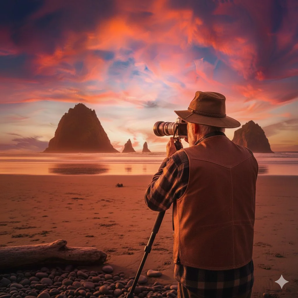
Join an old man with his camera
I’m Doug — a retired engineer, camera nerd, and your friendly photo guide. I don’t take your picture. I help you take them. I’ve spent decades building businesses, managing projects, mentoring interns, and chasing light. Now I guide curious folks through Bandon’s beauty — one shutter click at a time.
Our tours include professional guidance to help you find great photo spots, improve your technique, and create better images, and may include a curated experience tailored to your interests.
Cost: $80 (I’m retired)
What to expect
Guided experience: I will take you to specific locations to maximize your photographic opportunities within a two-hour timeframe, usually starting 60-90 minutes before sunset, for the best sunset experience.
Personalized assistance: I can help you with specific technical questions, creative ideas, or in finding the best angles and compositions, regardless of your skill level.
Location scouting: I have local knowledge of the best spots for various lighting conditions and scenes, which saves you time and effort trying to find the top locations on your own.
❓ FAQ
See our Frequently Asked Questions section.
Questions?
email me: doug@OneEyeFocus.com
Book a Photo Walk
Send a Comment:
🌊 The Legend of Face Rock
The Face Rock legend is one of those stories that feels like it was made for the Bandon coastline—mysterious, dramatic, and just a little bit haunting. Since you’re living right above that stretch of coast now, it hits differently when you know the lore behind the silhouette you see every evening.
The most widely told version comes from local Coquille (Ko-Kwel) tribal tradition. It goes like this:
A beautiful princess named Ewauna traveled with her people to the coast. One night, while the others slept, she wandered down to the beach with her dog, Komax, enchanted by the moonlight on the water. She waded into the ocean, unaware that Seatka, an evil ocean spirit, lurked beneath the waves.
Seatka tried to lure her under, but Ewauna resisted. She held her head above the water, refusing to look into his eyes—because to look directly at Seatka meant falling under his power. Komax barked and howled from the shore, trying to warn her.
Seatka, enraged, sent waves crashing over them. By morning, the princess, her dog, and the smaller rocks around them had turned to stone.
Face Rock is Ewauna’s face, still defiantly above the water, eyes toward the sky.
Cat and Kittens are said to be Komax and the smaller animals who tried to save her.
Wizard’s Hat is sometimes interpreted as Seatka himself.
It’s a story about resistance, courage, and refusing to bow to a dark force—even when the tide is rising.
🌅 Why the story sticks
There’s something uncanny about how perfectly Face Rock resembles a woman’s profile. At sunset, especially on a low tide, it feels like the coastline is telling the story all over again. And if you’re out there with a camera, the legend adds a layer of meaning to the light, the tide, and the mood of the scene.
Top Photo Locations
The top beachscapes for landscape photography within a 100-mile radius of Bandon, Oregon. The range extends North to Seal Rock/Waldport, South to Crescent City, California, and focuses on locations offering distinct geological features like sea stacks, tide pools, lighthouses, or dramatic cliffs rather than just flat sandy shores.

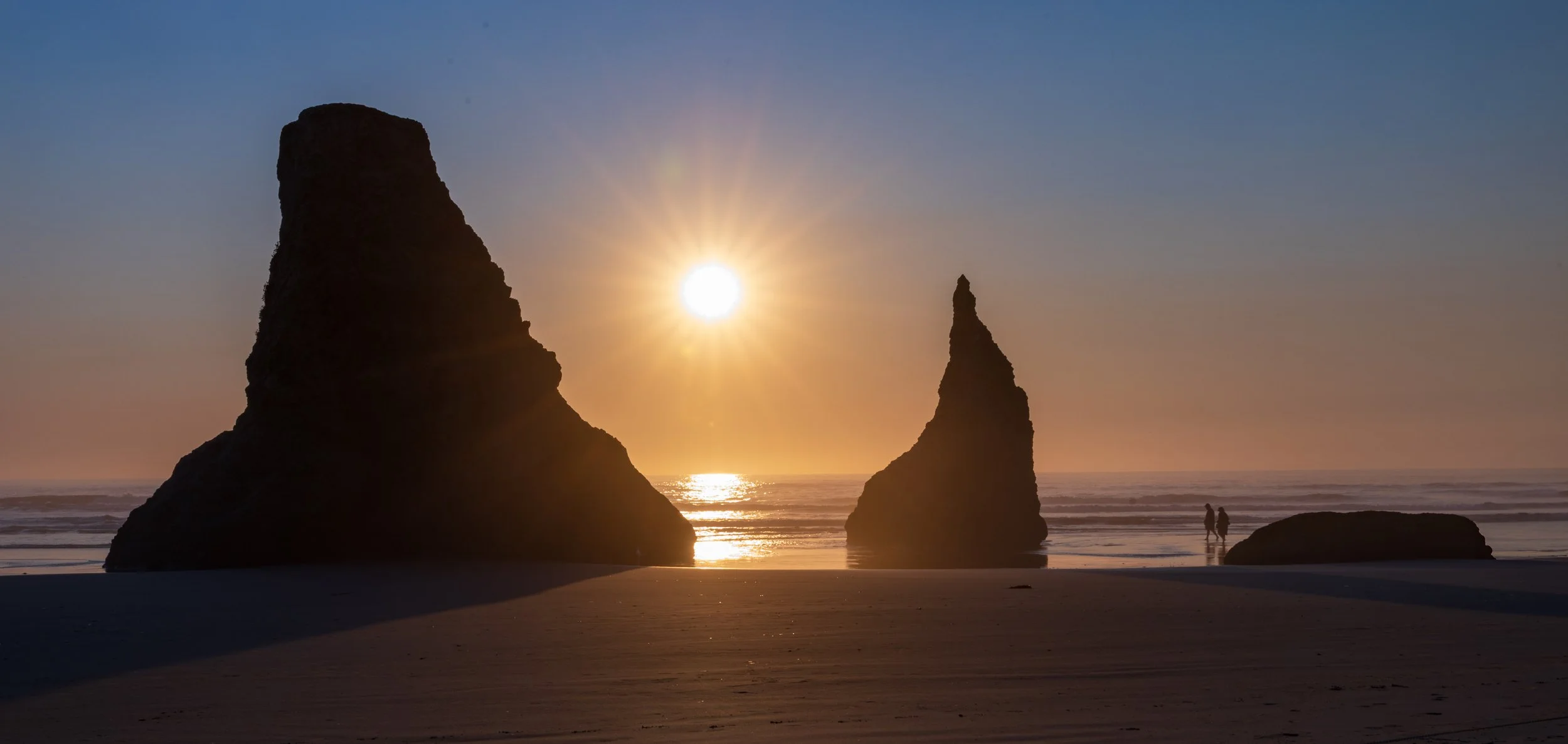
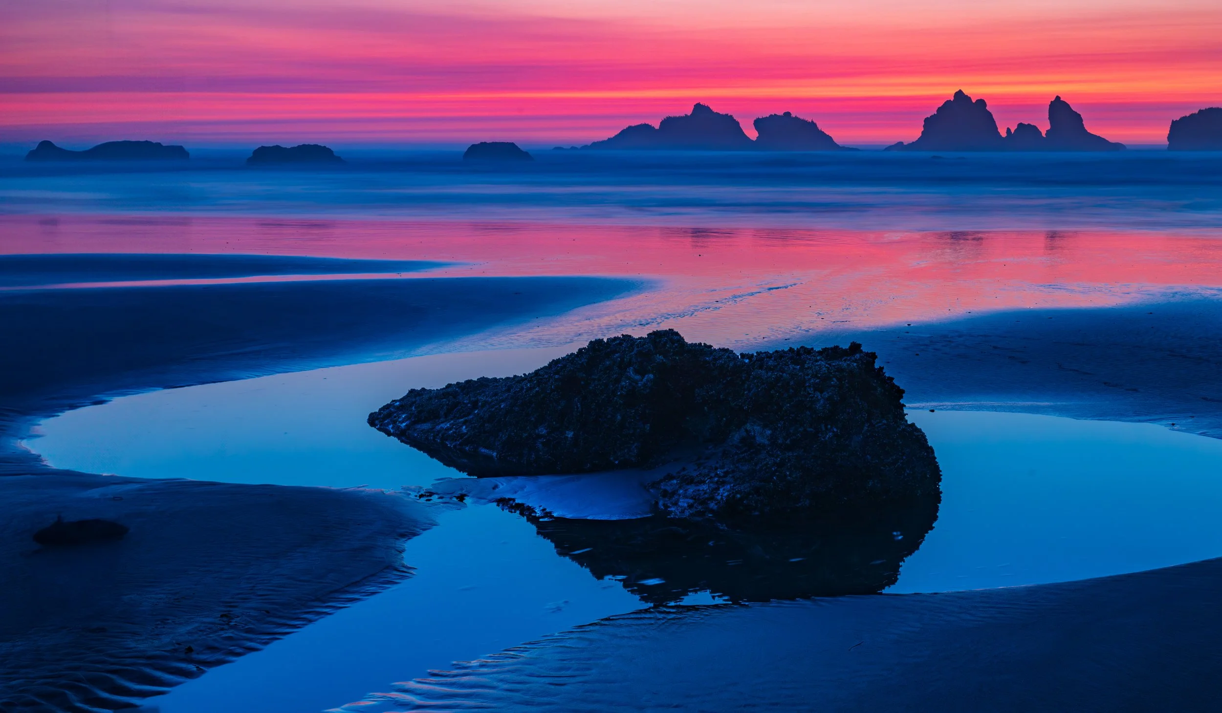
Bandon Face Rock at Sunset
Photo Opporties close to Bandon Oregon
Bandon Beach
Photo Opportunities Close to Bandon Oregon
The top beachscapes for landscape photography within a 100-mile radius of Bandon, Oregon. The range extends North to Seal Rock/Waldport, South to Crescent City, California, and focuses on locations offering distinct geological features like sea stacks, tide pools, lighthouses, or dramatic cliffs rather than just flat sandy shores.
Immediate Bandon Area (0–10 miles)
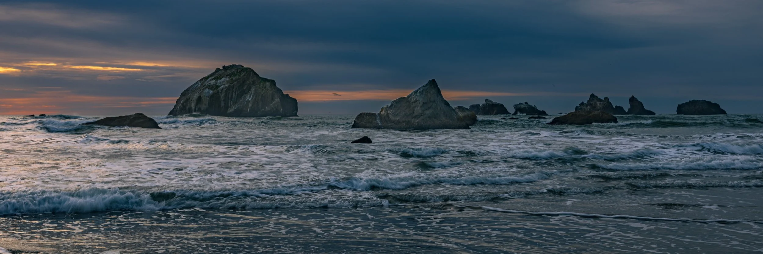
The world-class locations right on Bandon’s doorstep, famous for sea stacks and rock formations.
Face Rock State Scenic Viewpoint:
The iconic Bandon shot. Best at sunset when light hits "Face Rock" and the "Wizard’s Hat."
GPS: 43.1096° N, 124.4344° W
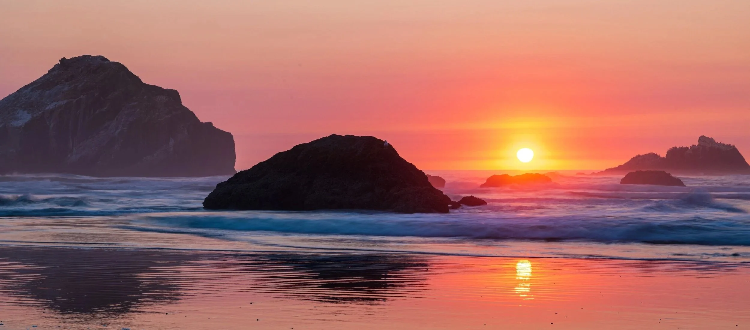
Face Rock at Sunset
Beautiful princess Ewauna (Face Rock) and her kittens
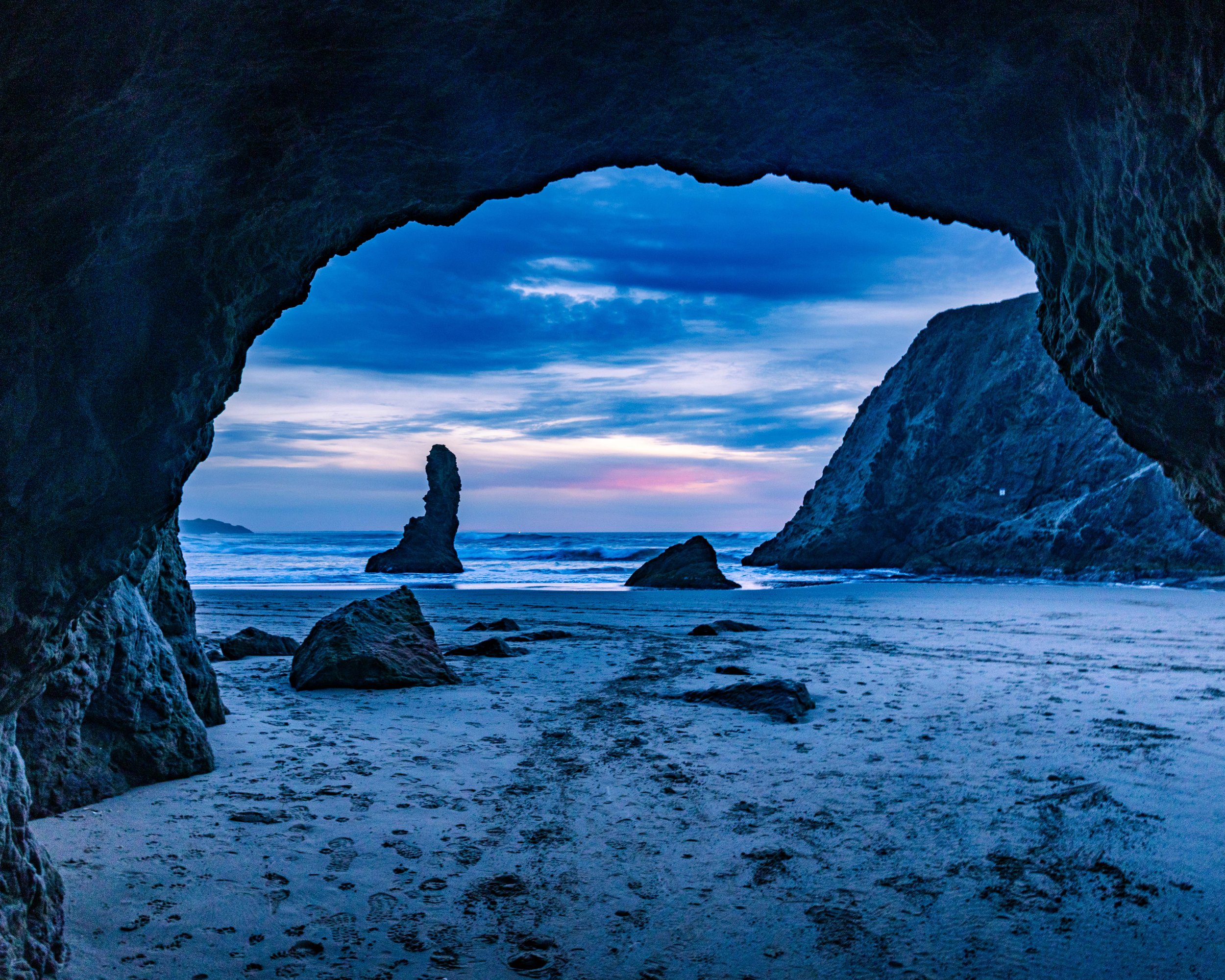
Cave at Face Rock
Coquille Point:
Accessed from the end of 11th St SW, this headland offers staircases down to a beach filled with massive formations like Table Rock and Elephant Rock.
GPS: 43.1135° N, 124.4340° W
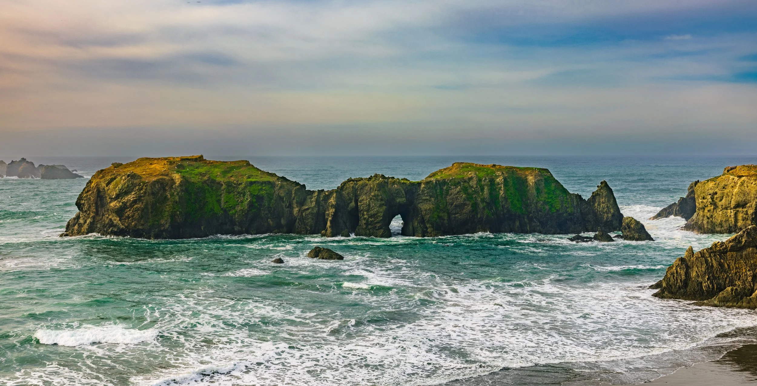
Elephant Rock at Coquille Point
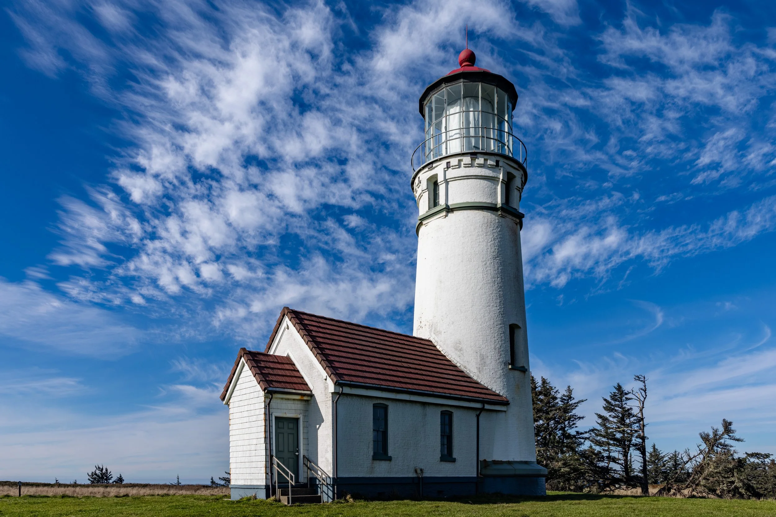
Bullards Beach State Park:
Famous for the Coquille River Lighthouse and massive driftwood graveyards near the jetty.
GPS: 43.1242° N, 124.4239° W (Coquille River Lighthouse)
South Jetty Park (Coquille River Lighthouse cross river view):
Offers a great vantage point of the lighthouse across the river and the dramatic breakwater rocks.
GPS: 43.1208° N, 124.4225° W
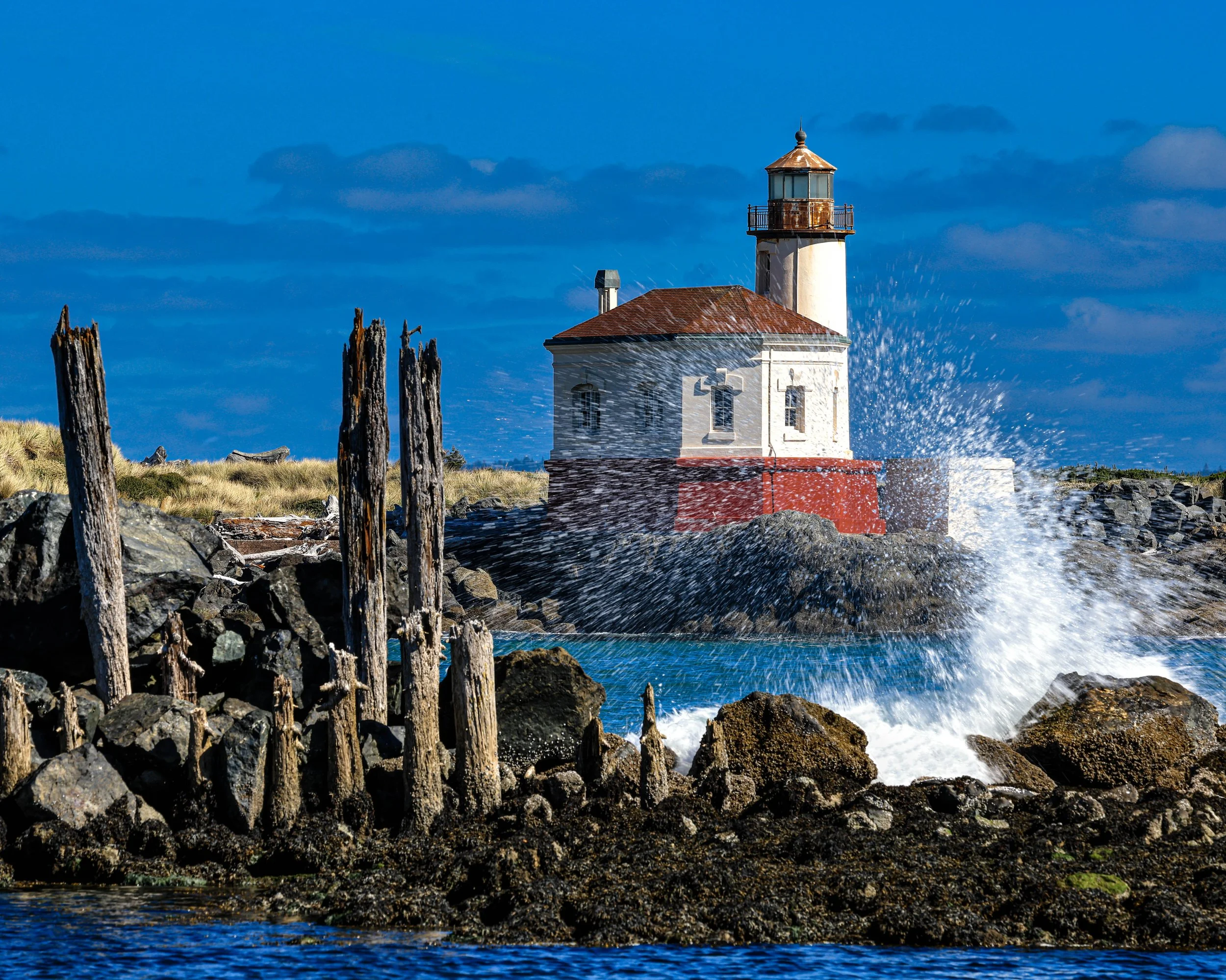
Coquille River Lighthouse
Seven Devils State Recreation Site:
A wilder, lonelier stretch of sand north of Bandon with agate beds and grassy dunes.
GPS: 43.2350° N, 124.3897° W
Floras Lake Beach:
Where a freshwater lake is separated from the ocean by a narrow sandstone dune wall.
GPS: 42.8969° N, 124.5024° W
Blacklock Point:
Requires a hike from the nearby airport, but offers dramatic cliffs and a secluded beach below.
GPS: 42.8647° N, 124.4850° W
Coos Bay / Charleston Area
Sunset Bay State Park:
A calm, circular bay protected by cliffs. Great for reflections and calm water shots.
GPS: 43.3343° N, 124.3710° W
Shore Acres State Park (Simpson Reef Overlook):
While technically a cliff-top park, the Simpson Reef Overlook offers unbeatable telephoto opportunities of crashing waves and sea lions on Shell Island.
GPS: 43.3219° N, 124.3744° W
Shore Acres State Park
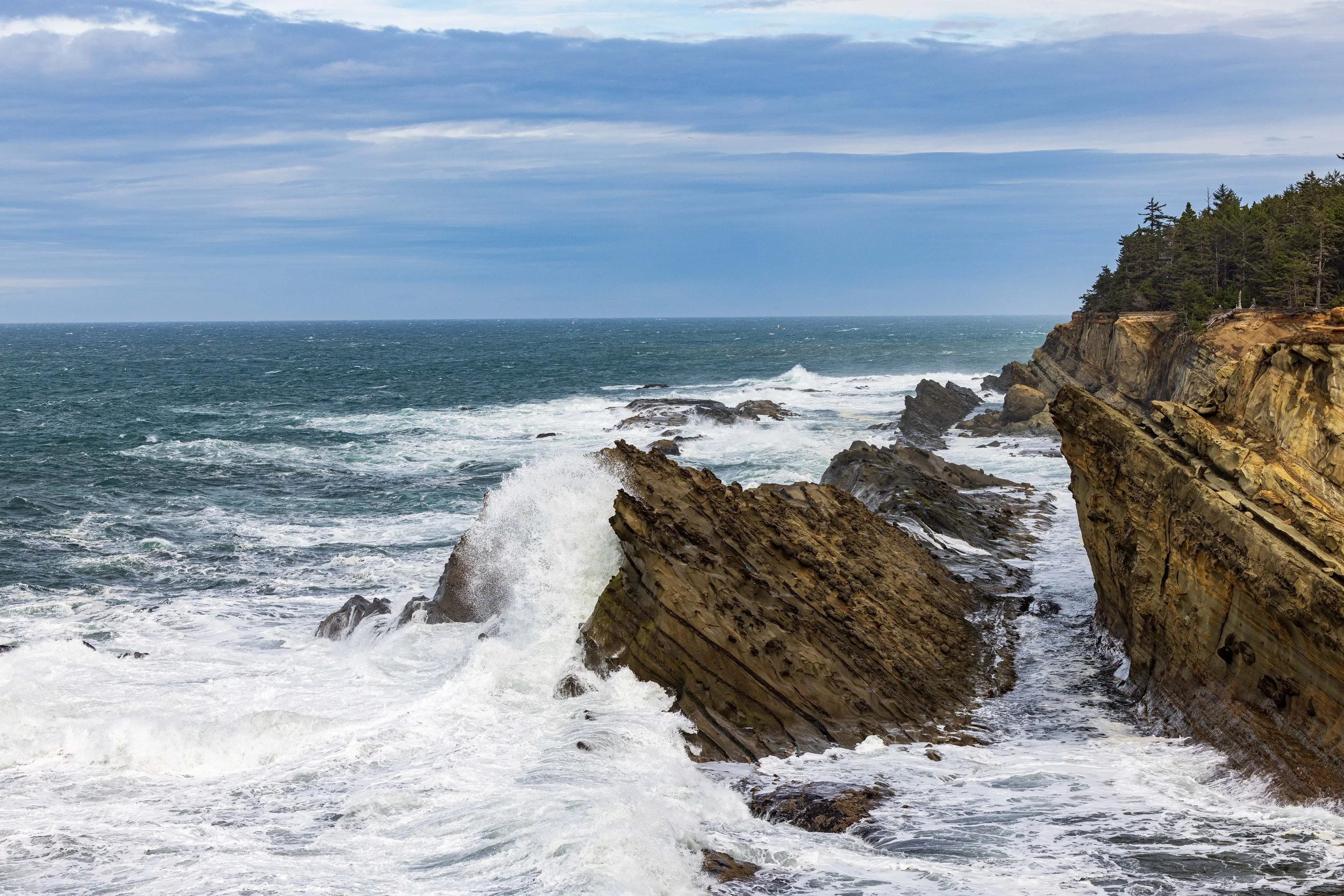
Cape Arago State Park (North & South Coves):
Trails lead down to rocky coves filled with tide pools and uplifted sandstone layers.
GPS: 43.3078° N, 124.3970° W
Yoakam Point:
A lesser-known pullout near scenic Bastendorff Beach offering unique rock formations.
GPS: 43.3444° N, 124.3589° W
John Dellenback Dunes Trail (Beach Access):
Located in the Oregon Dunes NRA, this requires a hike through massive sand dunes to reach a pristine, empty beach.
GPS: 43.5839° N, 124.1853° W
Horsfall Beach:
A vast expanse of sand and dunes; excellent for minimalist long-exposure photography.
GPS: 43.4627° N, 124.2853° W
Florence Area
South Jetty Beach (Florence):
Known for its grass-covered dunes and access to the Siuslaw River jetty.
GPS: 43.9939° N, 124.1386° W
Heceta Beach:
A broad sandy beach that offers a distant view of the Heceta Head lighthouse to the north.
GPS: 44.0207° N, 124.1298° W
Heceta Head Lighthouse Beach (Devil’s Elbow):
The classic postcard shot of the lighthouse from the beach below, framed by the bridge.
GPS: 44.1374° N, 124.1278° W
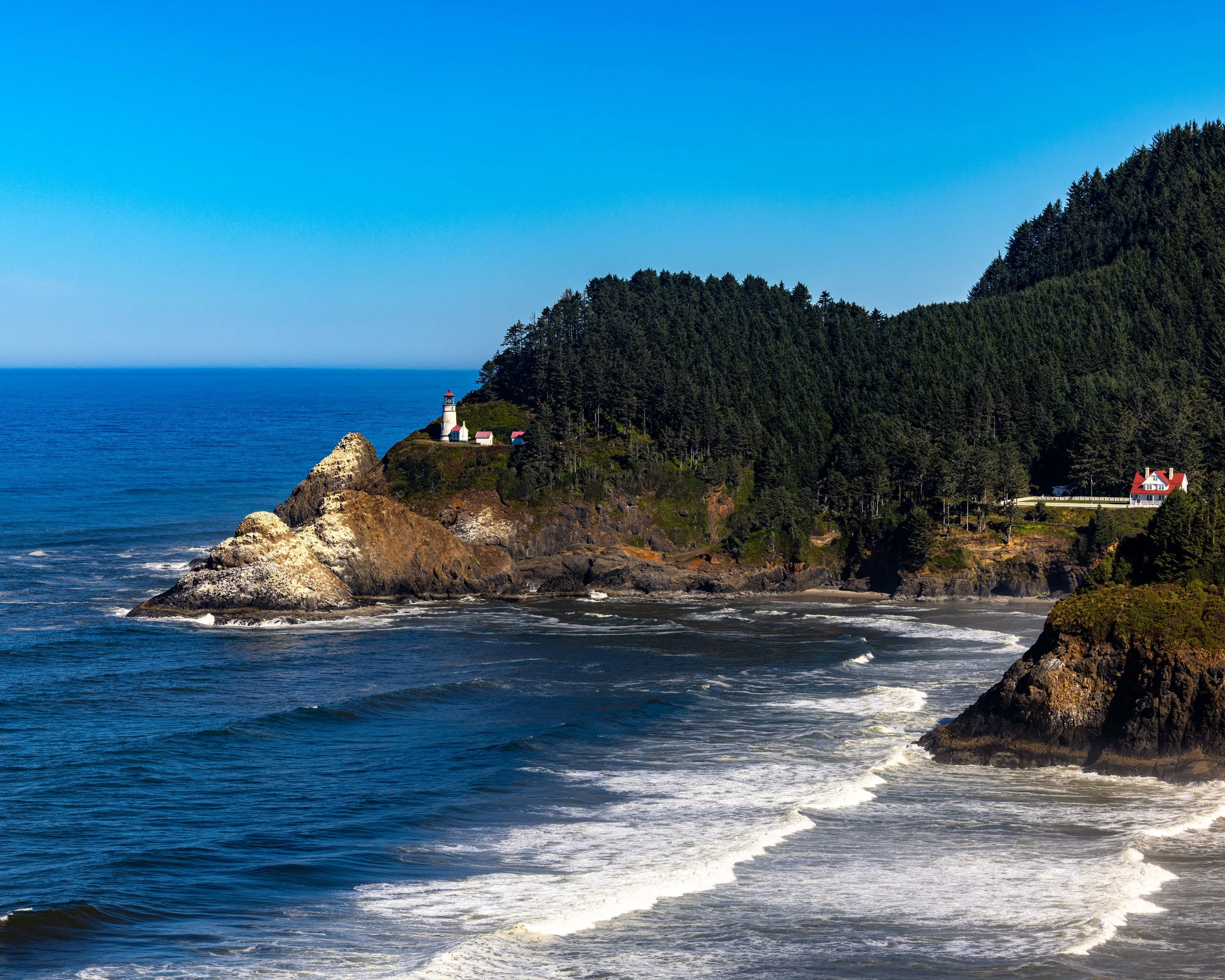
Heceta Head Lighthouse
Hobbit Beach:
A magical, fern-lined trail leads to this secluded beach.
GPS: 44.1622° N, 124.1171° W
Muriel O. Ponsler Memorial State Scenic Viewpoint:
Easy roadside access to a curved beach perfect for sunset reflections.
GPS: 44.1745° N, 124.1162° W
Tokatee Klootchman State Natural Site:
A small, high-bank wayside with views of a rugged, rocky shoreline.
GPS: 44.2000° N, 124.1155° W
Stonefield Beach:
Famous for Tenmile Creek flowing into the ocean and the pebble beds.
GPS: 44.2125° N, 124.1145° W
Bob Creek Wayside:
One of the best low-tide spots for starfish and tide pools, plus a small sea cave.
GPS: 44.2342° N, 124.1133° W
Strawberry Hill:
A jagged, rocky shelf that creates stunning waterfalls at low tide. Heavily populated by harbor seals.
GPS: 44.2505° N, 124.1147° W
Neptune State Scenic Viewpoint:
A rugged mix of rock benches and crashing waves.
GPS: 44.2639° N, 124.1142° W
Cape Perpetua (Thor’s Well & Spouting Horn):
Essential for dramatic wave action. Use a tripod and slow shutter speed here.
GPS: 44.2784° N, 124.1135° W
Devil’s Churn:
A narrow inlet where waves crash violently against volcanic rock walls.
GPS: 44.2844° N, 124.1098° W
Yachats Ocean Road:
A drive-along loop with easy access to rocky shelves and tide pools.
GPS: 44.3060° N, 124.1050° W
Seal Rock State Recreation Site (Near the 100-mile limit):
Massive basalt chain of rocks protecting the beach; incredible geology.
GPS: 44.4982° N, 124.0848° W
Port Orford Area
Cape Blanco Lighthouse
Easy access to the Cape Blanco Lighthouse
GPS: 42.8367° N, 124.5628° W
Cape Blanco Lighthouse
Port Orford Heads State Park:
Trails lead to Lifeboat Cove and calm, stunning blue water views.
GPS: 42.7390° N, 124.5100° W
Battle Rock City Park:
Port Orford's main beach; the massive "Battle Rock" is accessible at low tide.
GPS: 42.7403° N, 124.4972° W
Humbug Mountain State Park:
The beach sits below the mountain, often featuring calm water and views of the highway bridge.
GPS: 42.6888° N, 124.4242° W
Sisters Rock State Park:
Two massive peaks connected to the shore by a tombolo. Great for climbing and drone photography.
GPS: 42.5947° N, 124.3989° W
Ophir Beach / Rest Area:
A long stretch of beach perfect for beachcombing and lonely landscape shots.
GPS: 42.5536° N, 124.3942° W
Gold Beach Area
Otter Point State Recreation Site:
Unique sandstone sculptures that look totally different from the basalt north of here.
GPS: 42.4619° N, 124.4222° W
Kissing Rock:
A distinct formation right off Hwy 101 in Gold Beach.
GPS: 42.3933° N, 124.4233° W
Meyers Creek Beach / Pistol River:
Famous for huge sea stacks (Haystack Rock South) and windsurfers. A landscape photographer favorite.
GPS: 42.3364° N, 124.4058° W
Cape Sebastian State Scenic Corridor:
Steep trails lead down to Hunter’s Cove, a crescent-shaped beach shielded by the cape.
GPS: 42.3156° N, 124.4214° W
Brookings Area
Secret Beach:
Accessible via a steep trail; features a waterfall that spills onto the beach and massive sea stacks.
GPS: 42.1917° N, 124.3669° W (Trailhead at Thunder Rock Cove)
Natural Bridges:
While the famous shot is from the viewpoint, trails lead down to the water for a unique perspective of the arches.
GPS: 42.1900° N, 124.3660° W (Viewpoint)
Indian Sands:
A unique landscape of sand dunes perched high up on a cliff edge, eroding into the sea.
GPS: 42.1628° N, 124.3561° W
Whaleshead Beach
A broad, crescent-shaped beach offering accessible tide pools and dramatic sea stacks.
GPS: 42.1436° N, 124.3514° W
Lone Ranch Beach
A gentle, crescent beach with accessible tide pools and sea stacks.
GPS: 42.0983° N, 124.3428° W
Harris Beach State Park
Famous for "Arch Rock" and an incredible density of sea stacks just offshore.
GPS: 42.0669° N, 124.3042° W
Crescent City Area
Endert’s Beach
Just within range; famous for dark sand and tide pools at the southern end.
GPS: 41.7045° N, 124.1430° W