Top Photo Locations

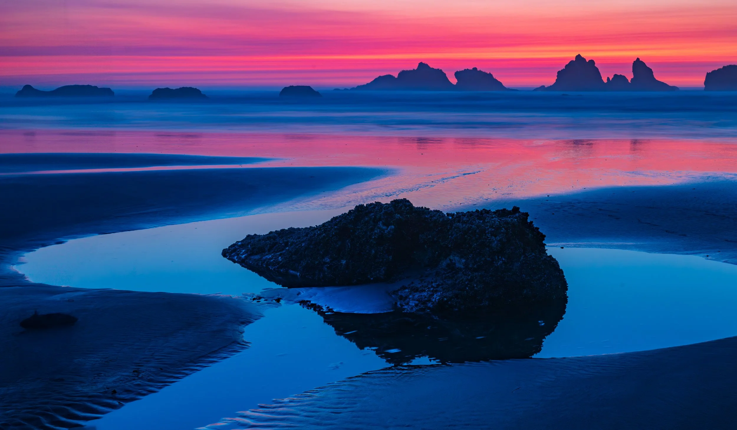
Bandon Face Rock at Sunset
Photo Opporties close to Bandon Oregon
Bandon Beach
Photo Opportunities Close to Bandon Oregon
The top beachscapes for landscape photography within a 100-mile radius of Bandon, Oregon. The range extends North to Seal Rock/Waldport, South to Crescent City, California, and focuses on locations offering distinct geological features like sea stacks, tide pools, lighthouses, or dramatic cliffs rather than just flat sandy shores.
Immediate Bandon Area (0–10 miles)
The world-class locations right on Bandon’s doorstep, famous for sea stacks and rock formations.
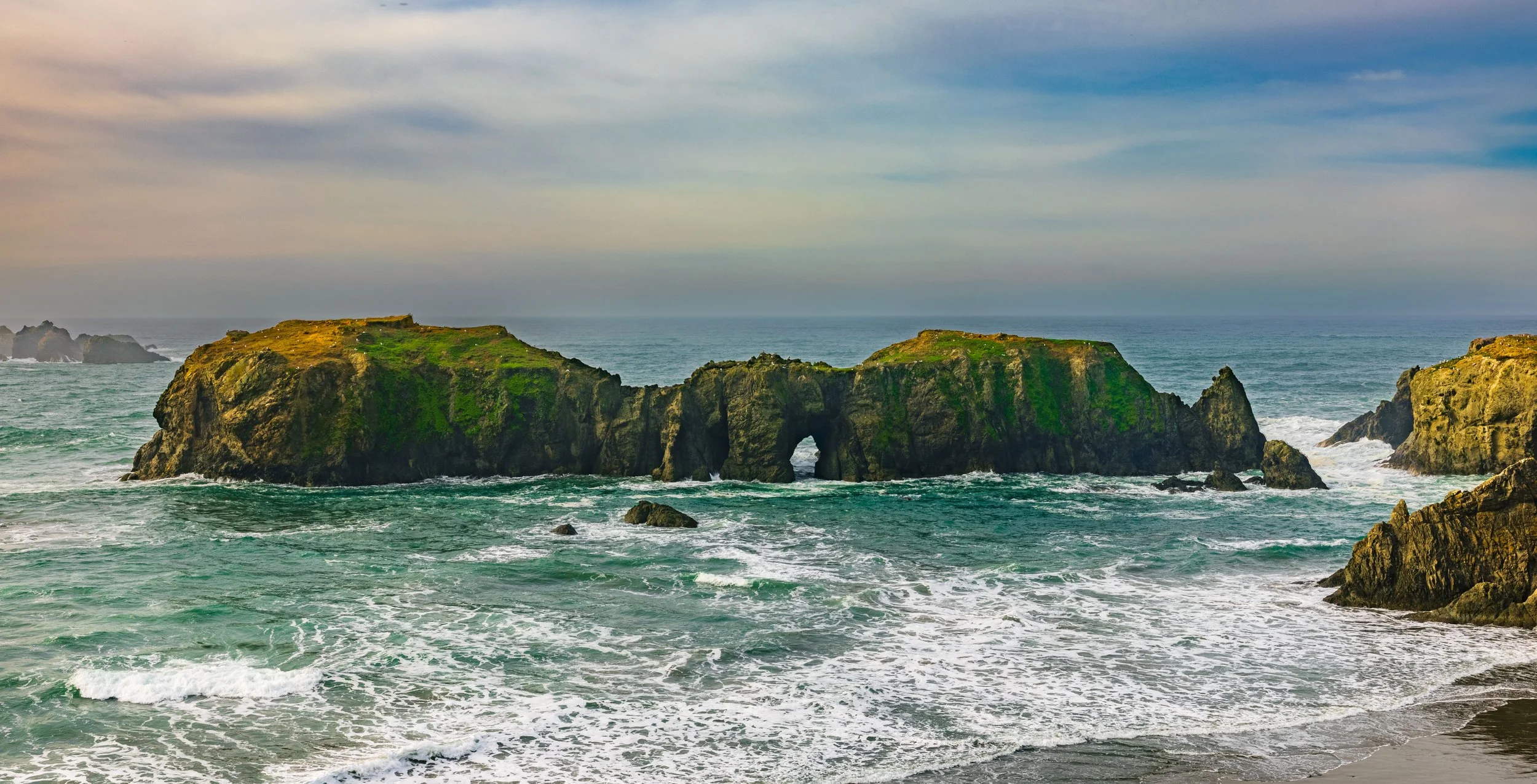
Face Rock State Scenic Viewpoint:
The iconic Bandon shot. Best at sunset when light hits "Face Rock" and the "Wizard’s Hat."
GPS: 43.1096° N, 124.4344° W
Face Rock at Sunset
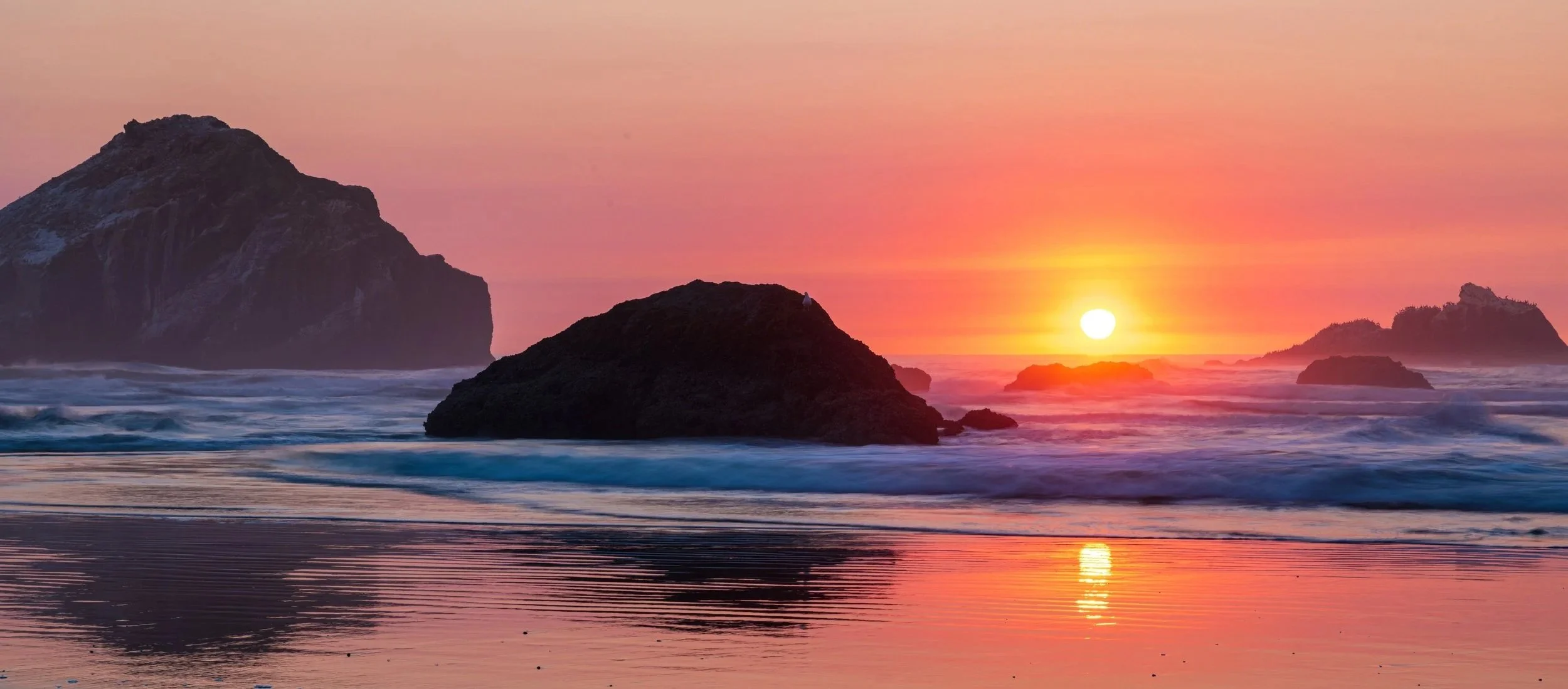
Beautiful princess Ewauna (Face Rock) and her kittens
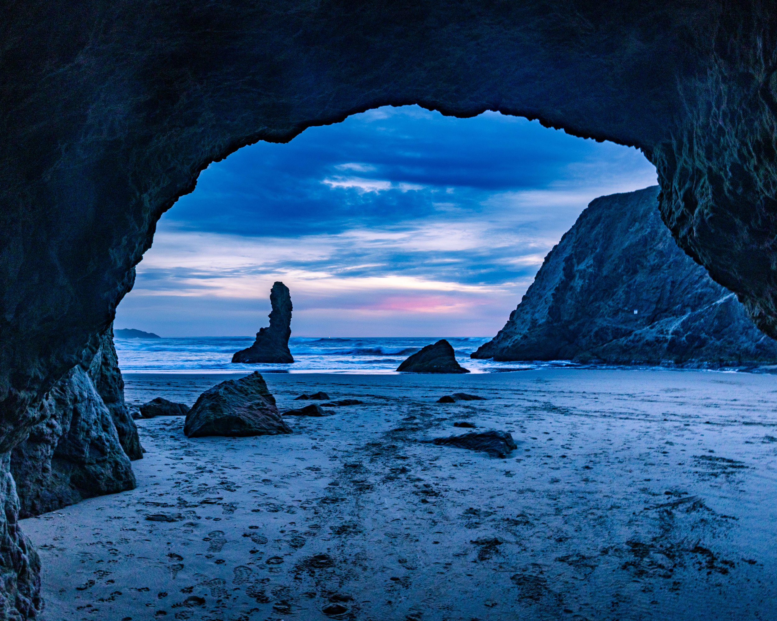
Cave at Face Rock
Coquille Point:
Accessed from the end of 11th St SW, this headland offers staircases down to a beach filled with massive formations like Table Rock and Elephant Rock.
GPS: 43.1135° N, 124.4340° W
Elephant Rock at Coquille Point
Bullards Beach State Park:
Famous for the Coquille River Lighthouse and massive driftwood graveyards near the jetty.
GPS: 43.1242° N, 124.4239° W (Coquille River Lighthouse)
South Jetty Park (Coquille River Lighthouse cross river view):
Offers a great vantage point of the lighthouse across the river and the dramatic breakwater rocks.
GPS: 43.1208° N, 124.4225° W
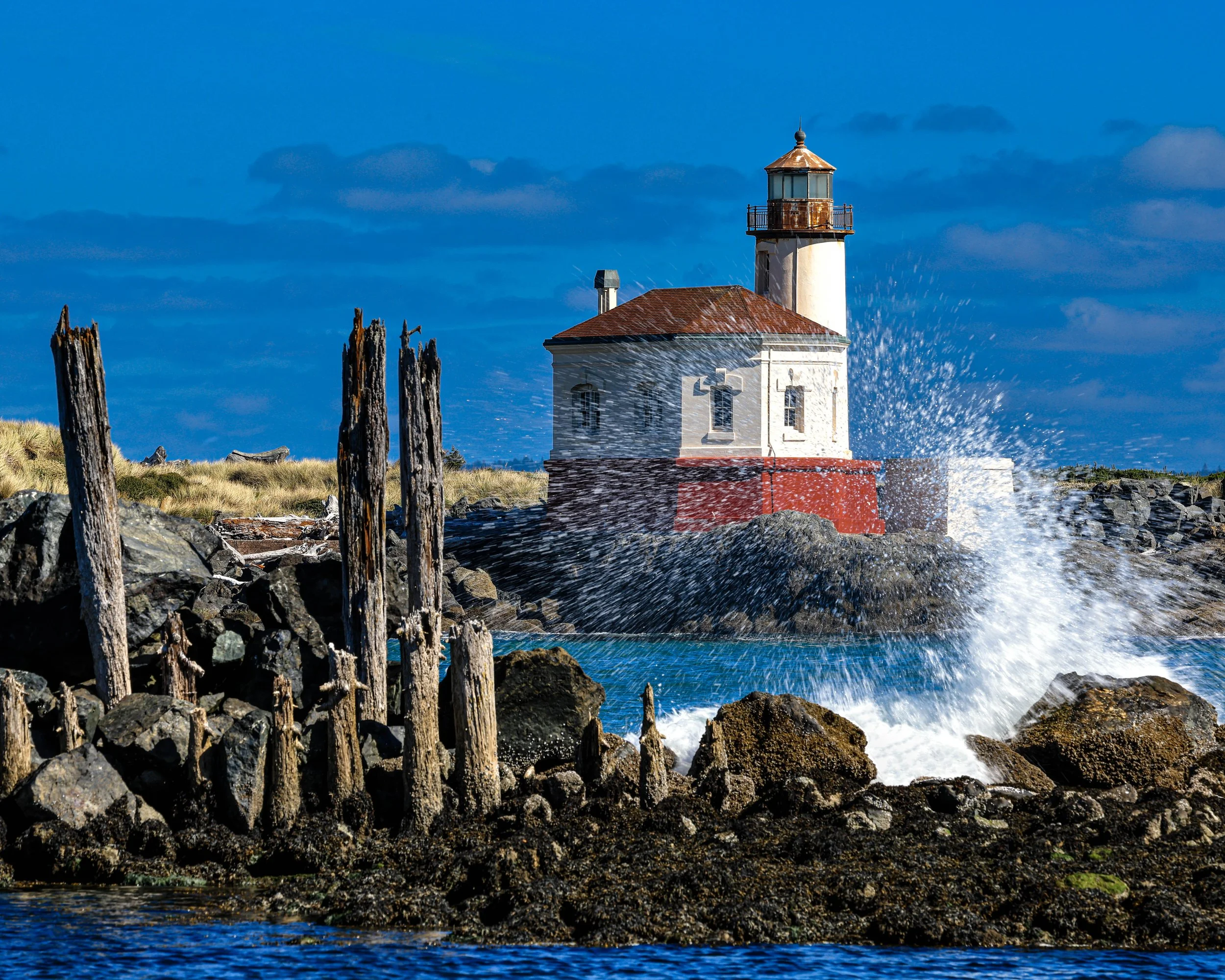
Coquille River Lighthouse
Seven Devils State Recreation Site:
A wilder, lonelier stretch of sand north of Bandon with agate beds and grassy dunes.
GPS: 43.2350° N, 124.3897° W
Floras Lake Beach:
Where a freshwater lake is separated from the ocean by a narrow sandstone dune wall.
GPS: 42.8969° N, 124.5024° W
Blacklock Point:
Requires a hike from the nearby airport, but offers dramatic cliffs and a secluded beach below.
GPS: 42.8647° N, 124.4850° W
Coos Bay / Charleston Area
Sunset Bay State Park:
A calm, circular bay protected by cliffs. Great for reflections and calm water shots.
GPS: 43.3343° N, 124.3710° W
Shore Acres State Park (Simpson Reef Overlook):
While technically a cliff-top park, the Simpson Reef Overlook offers unbeatable telephoto opportunities of crashing waves and sea lions on Shell Island.
GPS: 43.3219° N, 124.3744° W
Shore Acres State Park
Cape Arago State Park (North & South Coves):
Trails lead down to rocky coves filled with tide pools and uplifted sandstone layers.
GPS: 43.3078° N, 124.3970° W
Yoakam Point:
A lesser-known pullout near scenic Bastendorff Beach offering unique rock formations.
GPS: 43.3444° N, 124.3589° W
John Dellenback Dunes Trail (Beach Access):
Located in the Oregon Dunes NRA, this requires a hike through massive sand dunes to reach a pristine, empty beach.
GPS: 43.5839° N, 124.1853° W
Horsfall Beach:
A vast expanse of sand and dunes; excellent for minimalist long-exposure photography.
GPS: 43.4627° N, 124.2853° W
Florence Area
South Jetty Beach (Florence):
Known for its grass-covered dunes and access to the Siuslaw River jetty.
GPS: 43.9939° N, 124.1386° W
Heceta Beach:
A broad sandy beach that offers a distant view of the Heceta Head lighthouse to the north.
GPS: 44.0207° N, 124.1298° W
Heceta Head Lighthouse Beach (Devil’s Elbow):
The classic postcard shot of the lighthouse from the beach below, framed by the bridge.
GPS: 44.1374° N, 124.1278° W
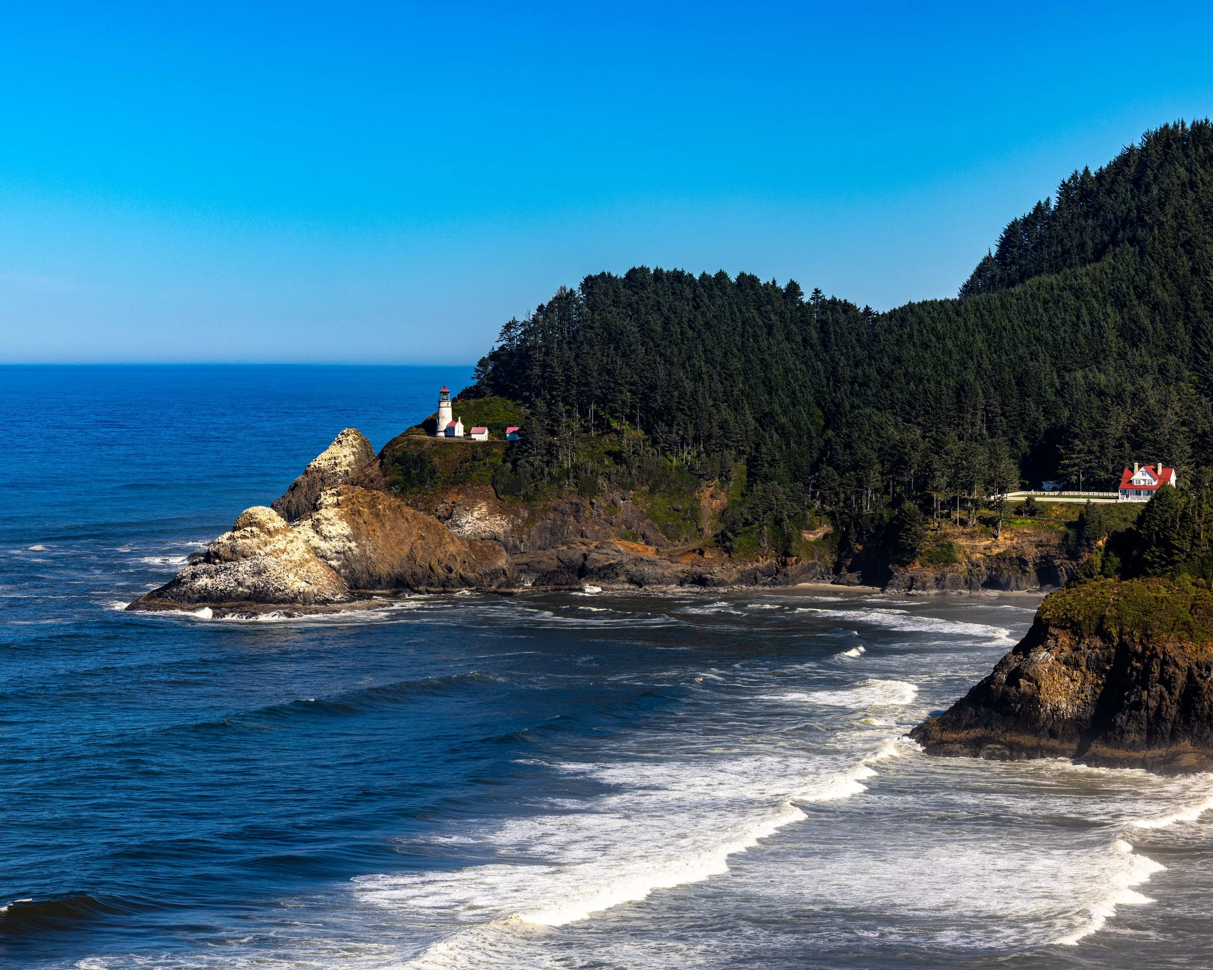
Heceta Head Lighthouse
Hobbit Beach:
A magical, fern-lined trail leads to this secluded beach.
GPS: 44.1622° N, 124.1171° W
Muriel O. Ponsler Memorial State Scenic Viewpoint:
Easy roadside access to a curved beach perfect for sunset reflections.
GPS: 44.1745° N, 124.1162° W
Tokatee Klootchman State Natural Site:
A small, high-bank wayside with views of a rugged, rocky shoreline.
GPS: 44.2000° N, 124.1155° W
Stonefield Beach:
Famous for Tenmile Creek flowing into the ocean and the pebble beds.
GPS: 44.2125° N, 124.1145° W
Bob Creek Wayside:
One of the best low-tide spots for starfish and tide pools, plus a small sea cave.
GPS: 44.2342° N, 124.1133° W
Strawberry Hill:
A jagged, rocky shelf that creates stunning waterfalls at low tide. Heavily populated by harbor seals.
GPS: 44.2505° N, 124.1147° W
Neptune State Scenic Viewpoint:
A rugged mix of rock benches and crashing waves.
GPS: 44.2639° N, 124.1142° W
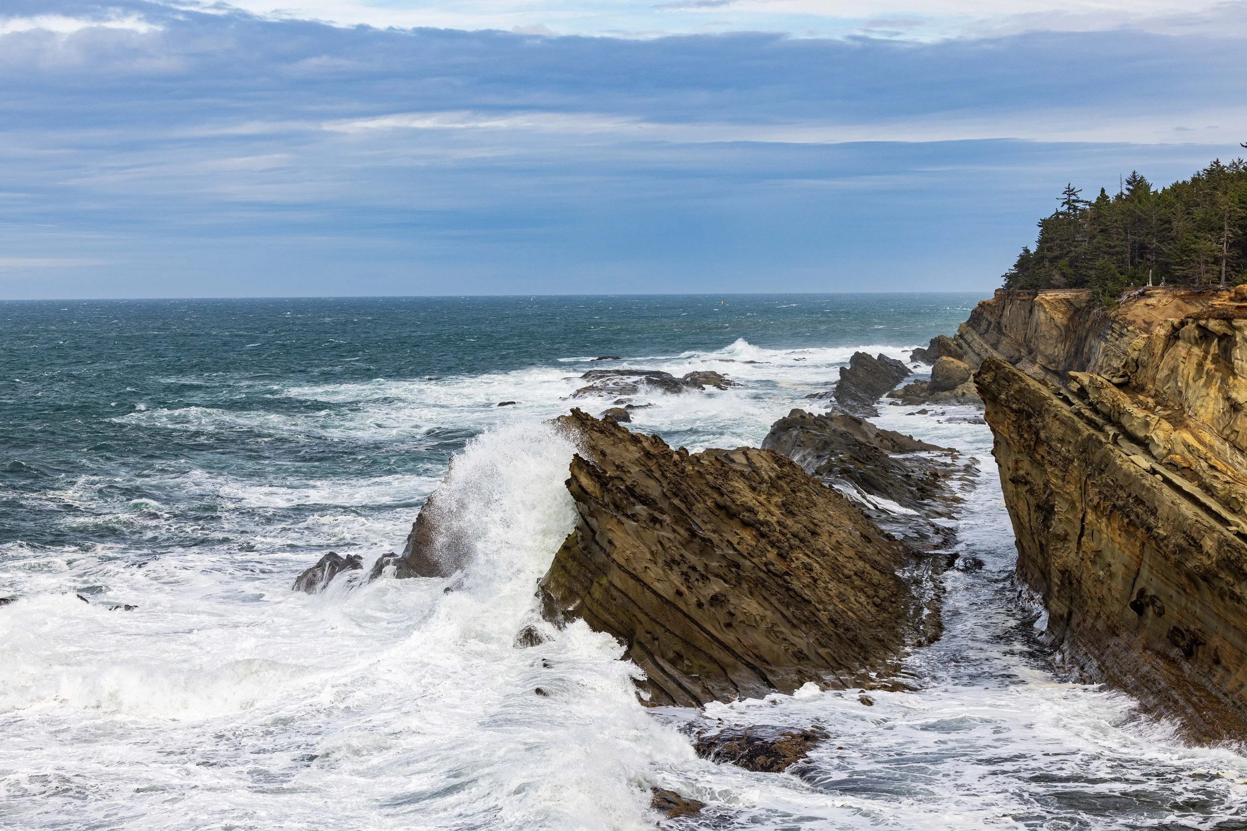
Cape Perpetua (Thor’s Well & Spouting Horn):
Essential for dramatic wave action. Use a tripod and slow shutter speed here.
GPS: 44.2784° N, 124.1135° W
Devil’s Churn:
A narrow inlet where waves crash violently against volcanic rock walls.
GPS: 44.2844° N, 124.1098° W
Yachats Ocean Road:
A drive-along loop with easy access to rocky shelves and tide pools.
GPS: 44.3060° N, 124.1050° W
Seal Rock State Recreation Site (Near the 100-mile limit):
Massive basalt chain of rocks protecting the beach; incredible geology.
GPS: 44.4982° N, 124.0848° W
Port Orford Area
Cape Blanco Lighthouse
Easy access to the Cape Blanco Lighthouse
GPS: 42.8367° N, 124.5628° W
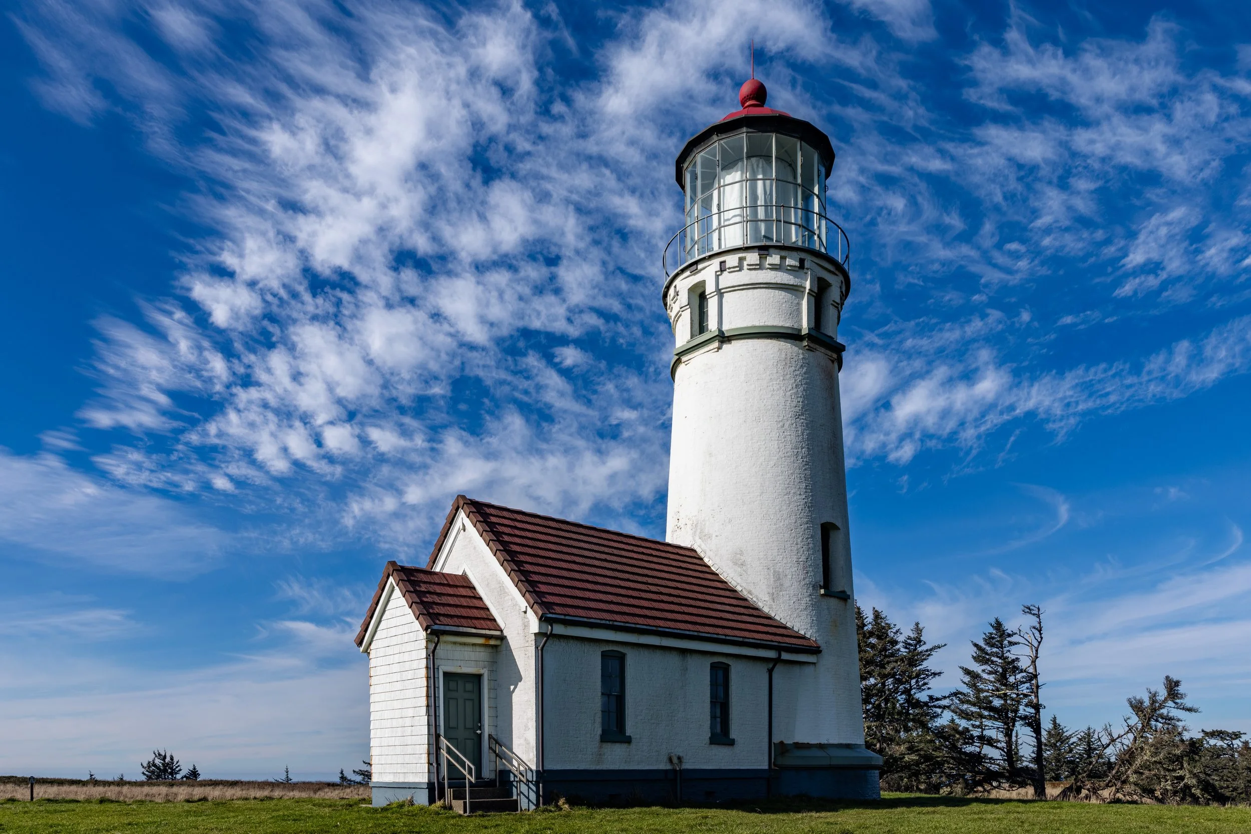
Cape Blanco Lighthouse
Port Orford Heads State Park:
Trails lead to Lifeboat Cove and calm, stunning blue water views.
GPS: 42.7390° N, 124.5100° W
Battle Rock City Park:
Port Orford's main beach; the massive "Battle Rock" is accessible at low tide.
GPS: 42.7403° N, 124.4972° W
Humbug Mountain State Park:
The beach sits below the mountain, often featuring calm water and views of the highway bridge.
GPS: 42.6888° N, 124.4242° W
Sisters Rock State Park:
Two massive peaks connected to the shore by a tombolo. Great for climbing and drone photography.
GPS: 42.5947° N, 124.3989° W
Ophir Beach / Rest Area:
A long stretch of beach perfect for beachcombing and lonely landscape shots.
GPS: 42.5536° N, 124.3942° W
Gold Beach Area
Otter Point State Recreation Site:
Unique sandstone sculptures that look totally different from the basalt north of here.
GPS: 42.4619° N, 124.4222° W
Kissing Rock:
A distinct formation right off Hwy 101 in Gold Beach.
GPS: 42.3933° N, 124.4233° W
Meyers Creek Beach / Pistol River:
Famous for huge sea stacks (Haystack Rock South) and windsurfers. A landscape photographer favorite.
GPS: 42.3364° N, 124.4058° W
Cape Sebastian State Scenic Corridor:
Steep trails lead down to Hunter’s Cove, a crescent-shaped beach shielded by the cape.
GPS: 42.3156° N, 124.4214° W
Brookings Area
Secret Beach:
Accessible via a steep trail; features a waterfall that spills onto the beach and massive sea stacks.
GPS: 42.1917° N, 124.3669° W (Trailhead at Thunder Rock Cove)
Natural Bridges:
While the famous shot is from the viewpoint, trails lead down to the water for a unique perspective of the arches.
GPS: 42.1900° N, 124.3660° W (Viewpoint)
Indian Sands:
A unique landscape of sand dunes perched high up on a cliff edge, eroding into the sea.
GPS: 42.1628° N, 124.3561° W
Whaleshead Beach
A broad, crescent-shaped beach offering accessible tide pools and dramatic sea stacks.
GPS: 42.1436° N, 124.3514° W
Lone Ranch Beach
A gentle, crescent beach with accessible tide pools and sea stacks.
GPS: 42.0983° N, 124.3428° W
Harris Beach State Park
Famous for "Arch Rock" and an incredible density of sea stacks just offshore.
GPS: 42.0669° N, 124.3042° W
Crescent City Area
Endert’s Beach
Just within range; famous for dark sand and tide pools at the southern end.
GPS: 41.7045° N, 124.1430° W